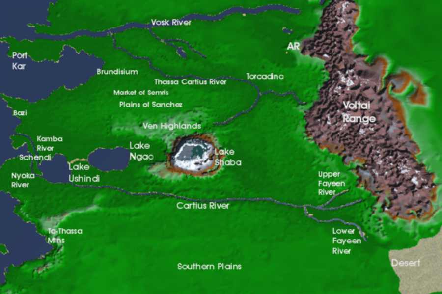
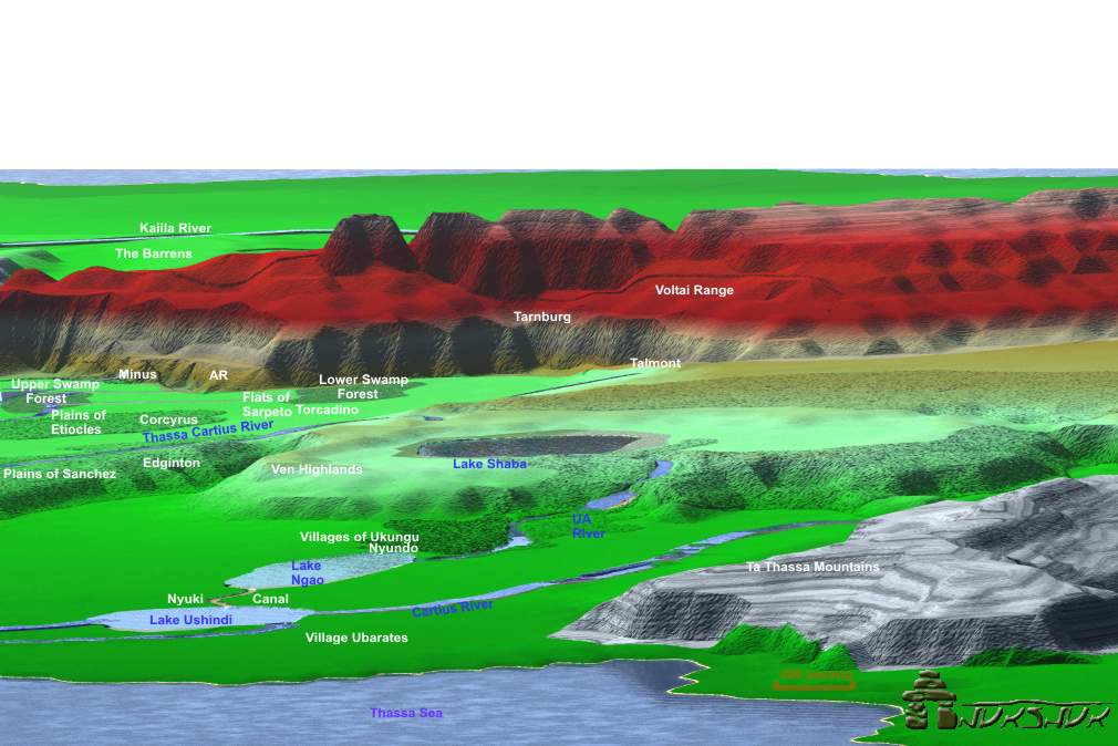
Presently the map of Gor is using 33,000 data points. This week the focus has been on determining the locations of places in the Ven Highlands - Plains of Sanchez Region.
The map to the right shows this region, north of Lake Shaba. Essentially I worked the whole area from the Thassa Sea near Bazi to Torcadino in the east. The Thassa Cartius is laid in and originates on the North slopes Lake Shaba.
The small undulations in the landscape are the new points. Much is missing north of the Thassa Cartius becuase I am not there yet.
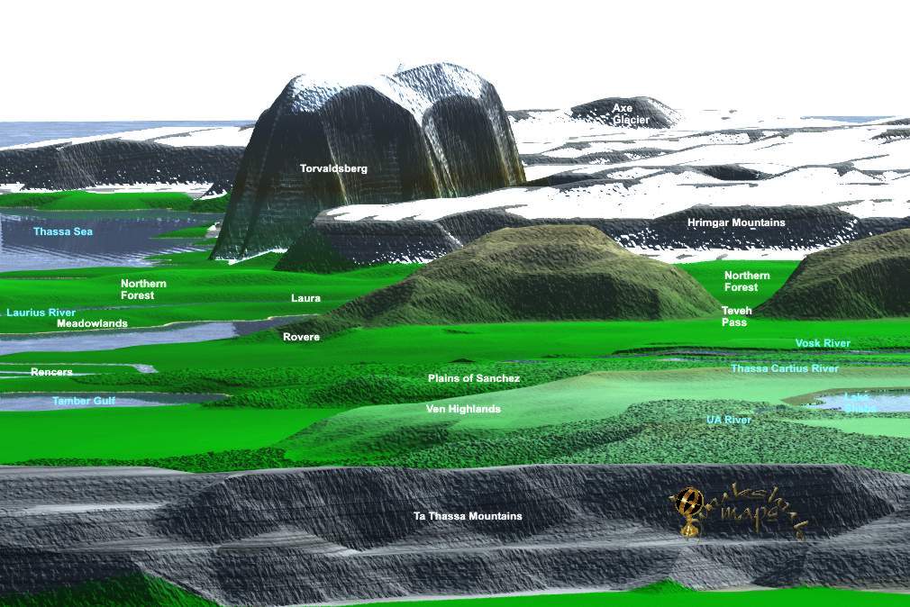
This is a view of the Region with some of the ecosystems starting to take shape. The Ven Highlands slope down toward the Thassa Cartius in the north. It is a high elevation region - what we might consider a Alpine or sub-Alpine region on earth. The trees are sparse, less dense then the Jungles of course and there are rock outcrops.
The area along the Thassa Cartius is grassland and the beginnings of agriculture which will extend later to the north-northeast. The Plains of Sanchez are quite flat, though not similar to the Southern Plains. They do have a few trees and the market of Senris can be found there as well as the town of Edgington.
The Thassa Cartius river begins north of Lake Shaba, it winds its way northeast then loops back to the northwest passing Torcadino. The river begins fast, falling from the lake then mellows into a wide meandering river. There are many flowers, for example dina, along the shores.
The actual source of the tributary to the Vosk, now called the Thassa Cartius, as you know, was found five years later by the explorer, Ramus of Tabor, who, with a small expedition, over a period of nine months, fought and bartered his way through the river tribes, beyond the six cataracts, to the Ven highlands. The Thassa Cartius, with its own tributaries, drains the highlands and the descending plains. Explorers of Gor Pg 16
The Plains of Sanchez are a large area, running east to west a distance of about 600 pasang or so. They are narrower and about 300-400 pasang wide. The Ven Highlands are about 400 pasang wide and about 200-300 pasang deep.
In this image are some of the ecosystems. You can see Lake Shaba to the left. The Thassa Sea is behind and immediately below is the Plains of Sanchez.
Along the river, in the silts begin the grasses and grains harvested for food. This is logical with respect to the Market of semris, which by the way is to the right in the larger greenish patch between the trees. One can cross these lands from Bazi on the Thassa, to the market of Semris, then continuing on toward Torcadino or head northeast toward AR and the Vosk River.
It owuld make sense to that Taluna and those originating from the Schendi Jungles would on occasion, but likely not often, venture out into these lands - cloaked. Many merchants would traverse the Plains of Sanchez.
Top down view of the Region. The ecosystems are started but will be added and changed later on the 20th go round more in line with the books. The reason I am putting them in now is I find it helps as I set elevations.
The area to the north is not yet completed fully. The Vosk River is evident and flows down into the Vosk Delta where later the lands of the Rencers and those of Port Kar will be done.
The yellowish areas are the beginnings of agricultural lands. To the north and northeast will be many more of them as I work that way.
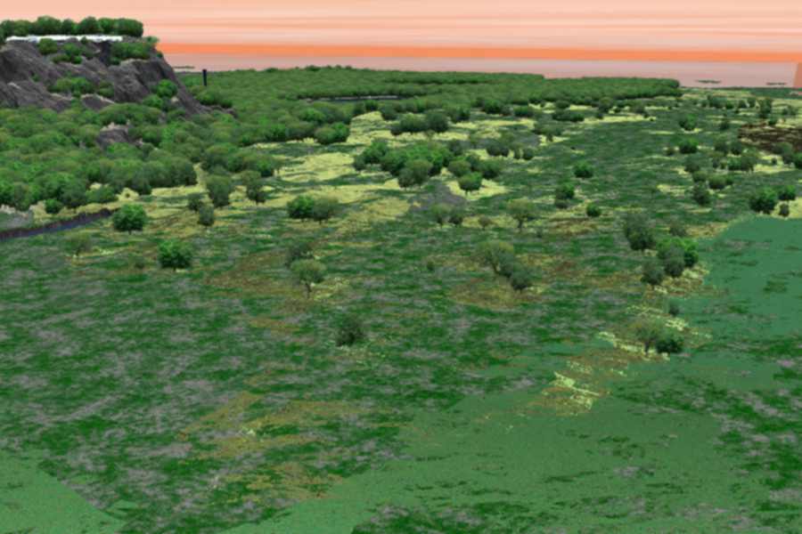
Picture of the Plains of Sanchez.
We were not in Samnium, but in Market of Semris.
This is a much smaller town, south, and somewhat to the east, of Samnium.
It is best known, interestingly enough, ironically enough, as an important
livestock market. In particular, it is famed for its sales of tarsks.
Too, of course, there are markets here for slaves.
Dancer of Gor Pg. 106
She stood not more than a hundred yards from
the gate of Tesius, in the city of Samnium, some two hundred pasangs east
and a bit south of Brundisium, both cities continental allies of the island
Ubarate of Cos..
Mercenaries of Gor Pg. 9
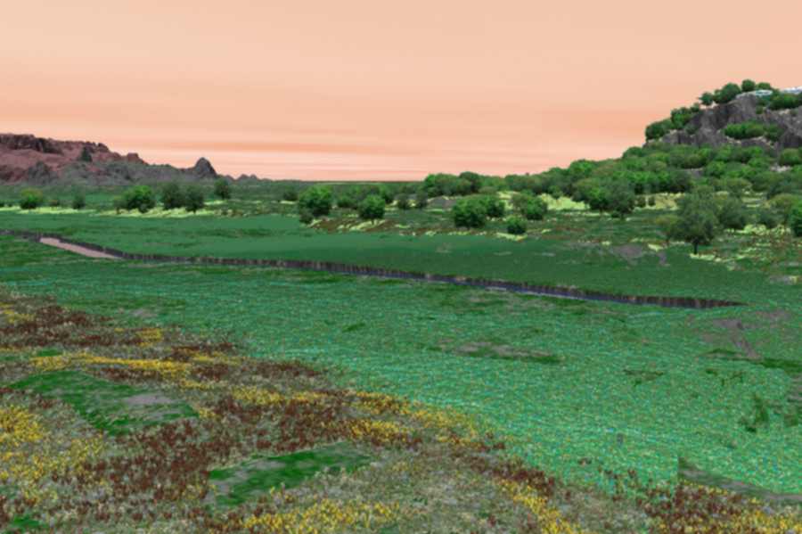
A picture along the northside of the Thassa Cartius River looking southwest. The edges of the Plains of Sanchez are behind.
I had heard it sung some two years ago by the
bargemen on the Cartius, a tributary of the Vosk, far to the south and
west of Ar. Assassin of Gor Pg 207

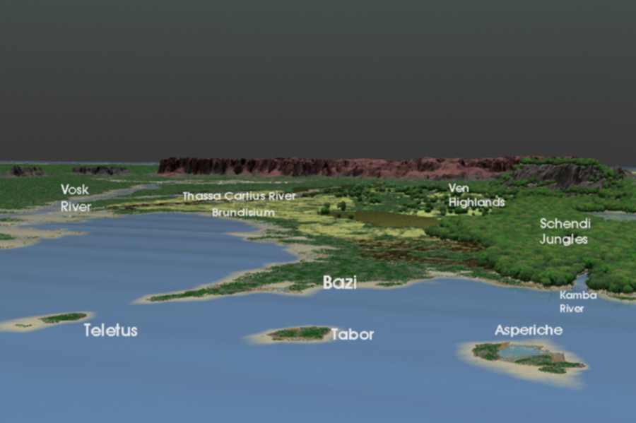
Finally, an image from the far west of Gor. This shows the three islands of Asperiche, Tabor and Teletus. Bazi is located and a road called the Genessian Road runs from Bazi back up through to Brundisium.
Note the Kamba River originating at the Thassa Sea as compared to the Nyoka River which also flows through the Jungles, but enters the Port of Schendi.
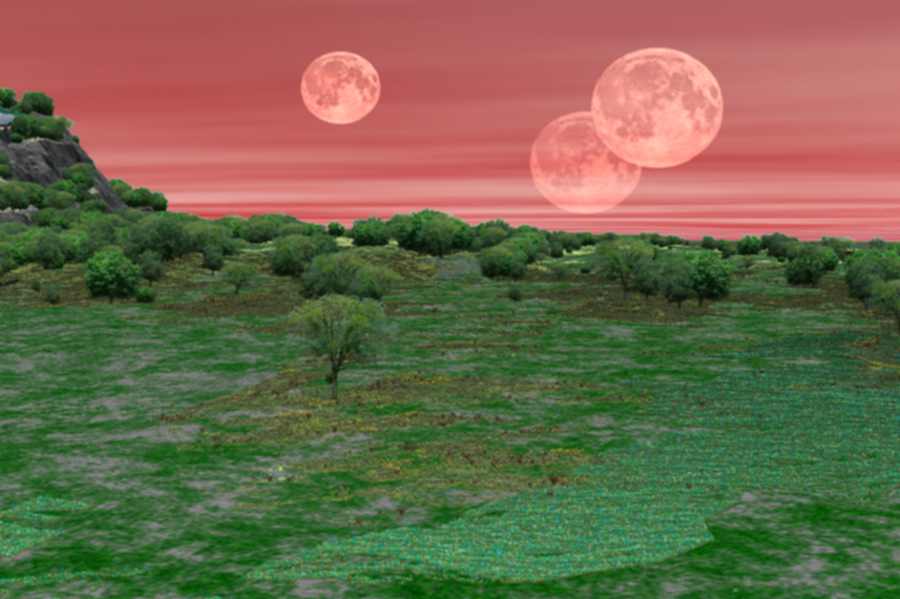
The Voltai Range is in the rear. I have been fiddling with stars and clouds and day and night. Maybe I will get a night scene in here shortly - this one is somewhat bare.
I understood that Brundisium was one of the
largest and busiest ports of this world. It was a commercial metropolis
of sorts..
Dancer of Gor Pg 147
Asperiche, incidentally, is an exchange island,
or free island, in Thassa. It is south of Teletus and Tabor. It is administered
by merchants.
Players of Gor Pg 129
Tabor is an exchange island in Thassa, south of Teletus. It is named for the drum, which, rearing out of the sea, it resembles. Hunters of Gor Pg. 42
There were several such islands. Three, which
I encountered frequently in my voyages, were Teletus, and, south of it,
Tabor, named for the drum, which it resembles, and, to the north, among
the northern islands, Scagnar. Others were Farnacium, Hulneth and Asperiche.
Raiders of Gor, Pg. 137
The distance to the outer islands is about 300 pasang or so.
My thanks to 'autumn NS' for her help in this as well as Karnik, ARES and riella 'X'.
Inukshuk - July 23, 2002