Presently the map of Gor is using 28,000 data points. I managed to add quite a few this week. The focus has been on determining the locations of places in the Schendi Region. A new map was generated from these updated points and is to the right. Keep in mind that I work only with one map that is in 3-D. You can see the numbers of points have increased substantially, particularly around the Schendi Jungles. The mountain in the middle is Lake Shaba. it has been estimated to be 'thousands' of feet high. There is reportedly a 'Lost City' in those mountains.
Each of the yellow dots can moved independently. This allows for maximum precision in placing the landscape elevations and coordinates of objects.
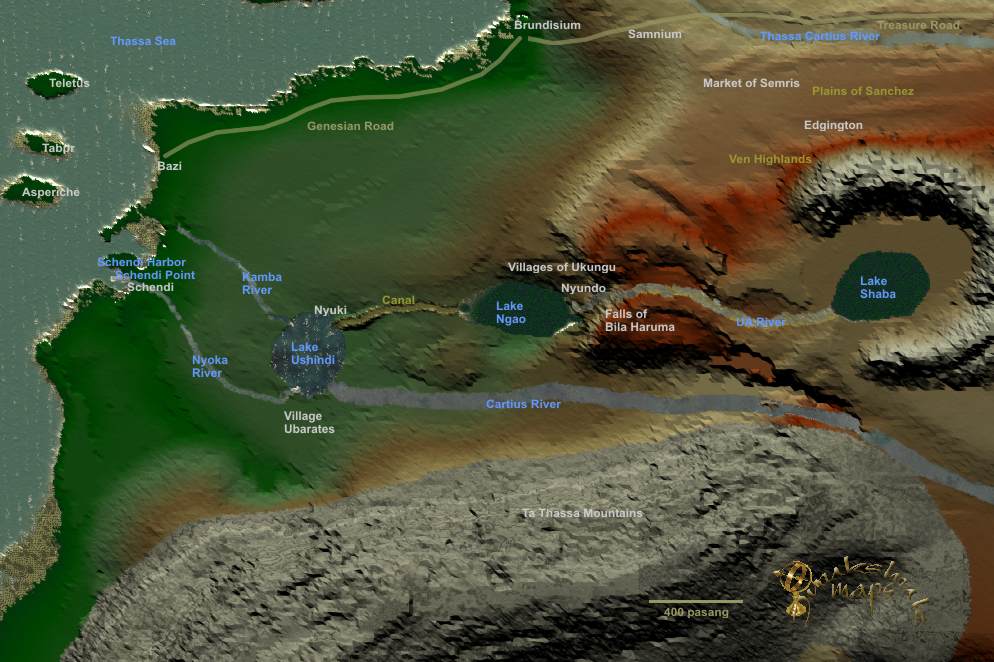
This is the latest view from the top-down perspective of the planet Gor. If you look closely you can see small undulations in the land. This is because if the increased numbers of coordinates for those regions. My concept has been to start from a distance, then zero in on the details later. This is because it is a lot of work. First the elevations and places have to be located then the finer details can be added.
You will notice the new Tahari Desert way down below the Voltai Range. This is in the books and the desert is 'wedge shaped'. It also makes sense because the mountains would create a drying effect on the leeward side of them. The Voltai is also known to be 'red' in color. It took about 15 minutes to generate this map in a fairly fast computer.The area to the east of the Voltai remains a mmystery to me at the moment. That is why you see no real detail there. I suspect it may be large, maybe 'autumn' can find some quotes to support that later.
When I refer to the 'Schendi region' I am talking about that area from the Thassa Sea to the Voltai Range that is bounded roughly by the Cartius River to the south and the Ven Highlands to the north. This picture shows the Lower Fayeen River that begins from the Voltai, feeds the Cartius then heads through the Jungles and on out to the Thassa Sea. There are both an Upper and Lower Fayeen Rivers.
"Tell me what you know of the Cartius," he
said.
"It is an important subequatorial waterway," I said. "It flows
west by northwest, entering the rain forests and emptying into Lake
Ushindi, which lake is drained by the Kamba and the Nyoka
rivers..
Explorers of Gor Pg 16
"Calculations performed by the
black geographer, Ramani, of the island of Anango, suggested that given
the elevations involved the two rivers could not be the same. His pupil,
Shaba, was the first civilized man to circumnavigate Lake Ushindi. He
discovered that the Cartius, as was known, enters Lake Ushindi, but that
only two rivers flow out of Ushindi, the Kamba and Nyoka." Explorers of
Gor P 16
It could be expected that these tributaries start high in the mountains, rushing down to the flatter lands. There they meet the Cartius and flow relatively swiftly but not overly fast, since the land is flat. It does border the Northern Plains and the Northern Salt Line, on the north side of the Cartius heads clear up to Torcadino and beyond.
The distance betwen Voltai and Jungles is about 400-600 pasang, depending upon where you measure.
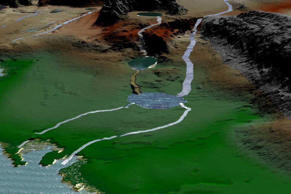
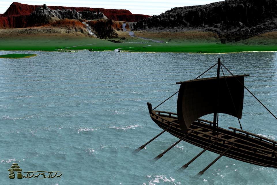
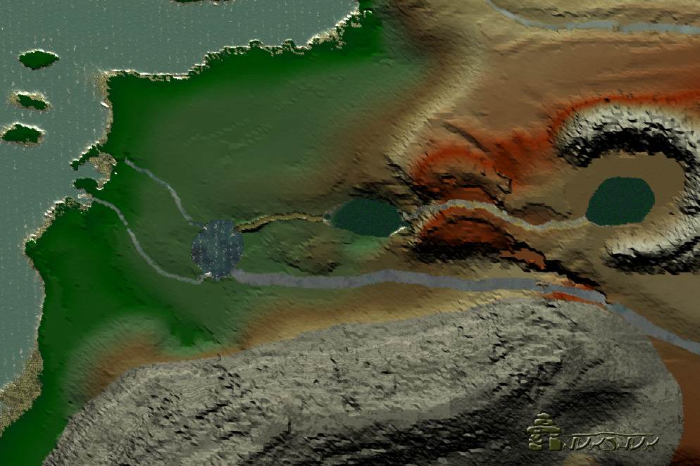
The first image is of the UA River falling down from Lake Shaba. There are several falls. The perspective here is looking up at a 45 degree angle. The water needs a bit of work later.
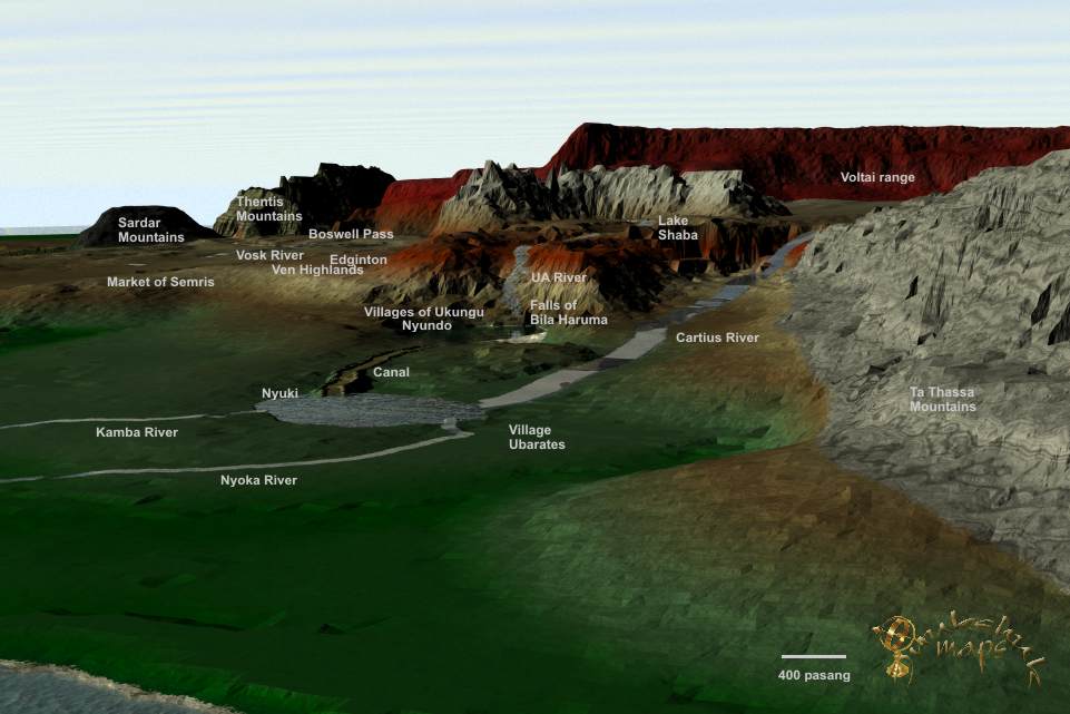
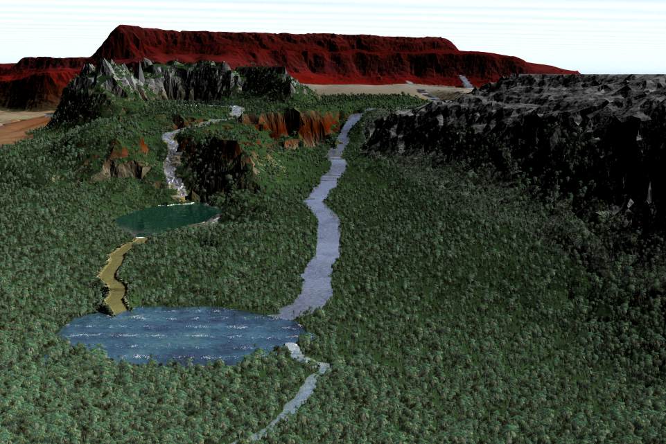
In this image are the beginnings of laying in the ecosystems. Normally I do that last, but many people have been asking for maps and I kinda got to wondering what it would look like. The tones on the landscapes are ecosystems. They are made wherever needed, are highly flexible and can include soils, plants, trees and rocks. You want one blade of grass put a certain place? Thats doable.
The intent of the engineers of Bila Huruma was
to set in place two parallel walls, low walls, some five or six feet high,
placed about two hundred yards apart. The area between these walls, the
marsh waters diverted on either side, was then to be drained and readied
for the digging of the main channel. In this work draft tharlarion and
great scoops, brought from the north, as well as gigantic work crews,
would be used. In the event that the central channel, when completed,
would not prove sufficient to handle the overflow of Ngao, as seemed
likely, conducting it geometrically to Ushindi, side channels were
contemplated. The eventual intent of Bila Huruma was not only to open the
rain forests of the deep interior, and whatever might lie within the
system of the Ua and her tributaries, to commercial exploitation and
military expansion, but to drain the marshes between the two mighty lakes,
Ushindi and Ngao, that that land, then reclaimed, thousands of square
pasangs, might eventually be made available for agriculture. It was the
intent of Bila Huruma not only to consolidate a ubarate but found a
civilization. Explorers of Gor Pg 220
I shrugged. Much of Gor was terra incognita. Few
knew well the lands on the east of the Voltai and Thentis ranges, for
example, or what lay west of the farther islands, near Cos and Tyros. It
was more irritating, of course, to realize that even considerable areas of
territory above Schendi, south of the Vosk, and west of Ar, were
unknown.
Explorers of Gor Pg 16
Already, though we were still perhaps thirty or
forty pasangs at sea, one could see clearly in the water the traces of
inland sediments. These would have been washed out to sea from the Kamba
and Nyoka rivers. These stains extend for pasangs into Thassa. Closer to
shore one could mark clearly the traces of the Kamba to the north and the
Nyoka to the south, but, given our present position, we were in the fans
of these washes. The Kamba, as I may have mentioned, empties directly into
Thassa; the Nyoka, on the other hand, empties into Schendi harbor, which
is the harbor of the port of Schendi, its waters only then moving thence
to Thassa.
Explorers of Gor Pg 99
For now the ecosystems are placed generally. One I get the whole maps elevations completed then I will focus on ecosystems. The rivers and other things might even change slightly the second and 20th time around.
The vegeation can be change by slope and by angle. Trees do not grow on 90 degree rock sides, so we limit those types of things. Similarly, certain species likely grow in certain areas. The books will provide clues later on.
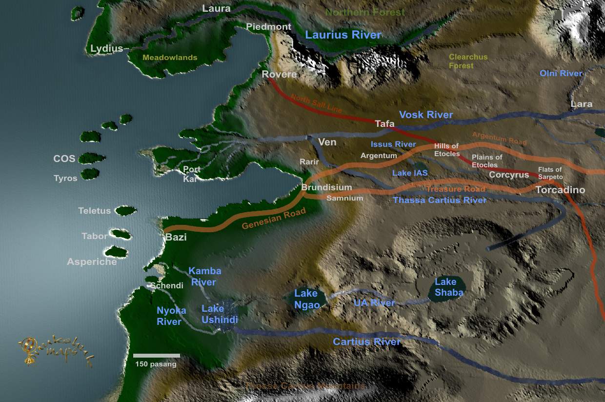
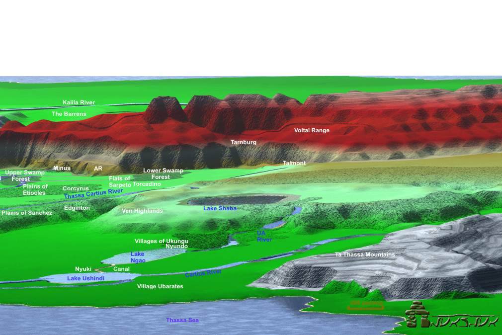
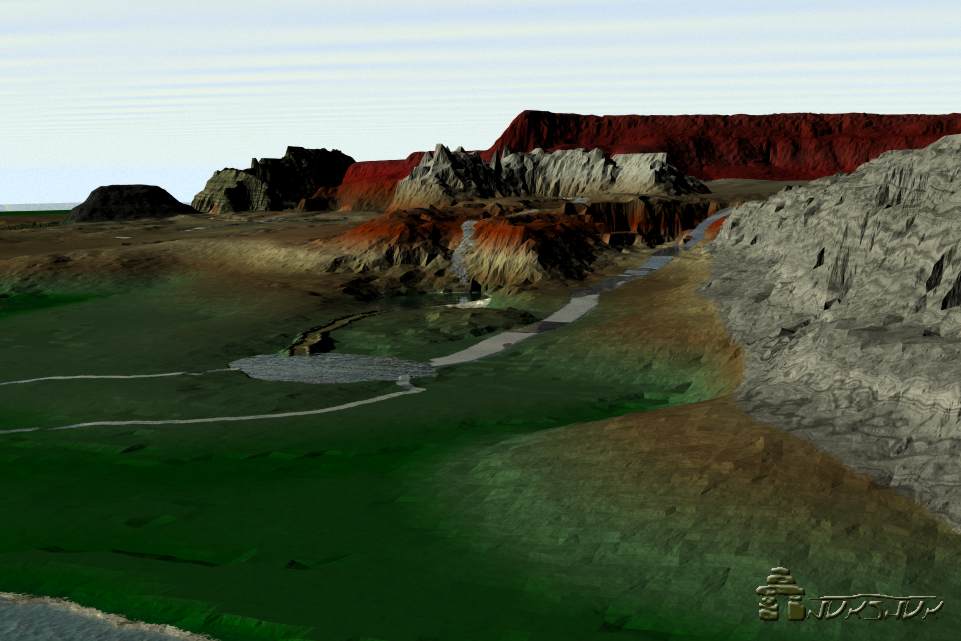
The view from the west of the Schendi Jungles to the east shows the Thassa Sea in the bottom. Lake Shaba rising in the middle and the Voltai Range in the back with the Plains to the far upper right.
"And it was there that he discovered that Lake
Ngao was fed, incredibly enough, by only one major river, as its eastern
extremity, a river vast enough to challenge even the Vosk in its breadth
and might, a river which he called the Ua." "Yes," said Samos.
"It is
impassable," I said, "because of various falls and cataracts." "The extent
of these obstacles, and the availability of portages, the possibility of
roads, the possibility of side canals, are not known," said Samos. "Shaba
himself, with his men and boats, pursued the river for only a hundred
pasangs," I said, "when they were turned back by some falls and
cataracts." "The falls and cataracts of Bila Huruma, as he named them,"
said Samos. Explorers of Gor Pg 19
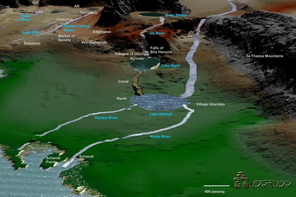
The port of Schendi sits within a bay. The Nyoka River, flowing from Lake Ushindi passes through the Jungle to enter the bay near the port of Schendi. It was largely thought that the other river, from Lake Ushindi - the Kamba River entered the port at the bay. That is not the case. The Kamba River flows north from Lake Ushindi, then enters directly into the Thassa Sea some 200 pasang north of the port of Schendi. Jungles surround both rivers.
This low lying jungle area is moist. The vegetation lush and resembles a jungle. There are three 'tiers' in jungle, in other words, ecosystems by elevation within the canopies.
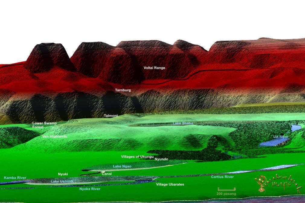
A view above Lake Shaba looking south toward the Plains clearly shows the elevation of the lake well above the surrounding Jungle. The Cartius River can be seen in the middle. It can be expected that sparse amounts of trees grow along the river and there are a number of flowering plants, all fed from the rivers moisture.
Then the marsh reeds parted and I saw, before us, sparkling in the sun, broad and shining, the waters of Lake Ngao. "How beautiful it is," breathed the blond-haired barbarian, in English.It had taken us fifteen days to reach the sill. We had lived by spear fishing, and drinking the fresh water of the marsh. The sun shone on the wide, placid waters. Explorers of Gor Pg 277
Lake Shaba itself is about 400 pasang from Lake Ngao, that lies to the west southwest. From Lake Shaba flows a river that is quite wide called the 'UA River'. In this mapping that river flows from the southern edge of Lake Shaba, then heads west to Lake Ngao. It descends rapidly so is very swift moving and very rocky. A canal runs from Lake Ngao to Lake Ushindi.
"It is so vast," said Ayari. "It is larger than Ushindi or Ngao," said Turgus. We guided our canoe over the shining, placid waters of a broad lake. "It is, I am confident," I said, "the source of the Ua.""Into it must flow a thousand streams," said Kisu. Two weeks ago we had come to another high falls, even higher than that from which we had, long ago, caught sight of the following forces of Bila Huruma, pasangs behind in the distance. We must be thousands of feet Gorean, given the length of the river, the numerous plunging cataracts, and the plateaus and levels we had ascended, above sea level, above the entrance points, west of Ngao and Ushindi, of the brown Kamba and Nyoka into the green waters of Thassa. From the falls at the edge of this unnamed lake we had been able to see far behind us. The river had been clear. Explorers of Gor Pg 417
At some point I would like to use 'Gorean' vegetation. In other words make all the plants look like Gorean plants. To do that I need drawings of single plants on a black background. They should be in color. Anyone know how to draw?
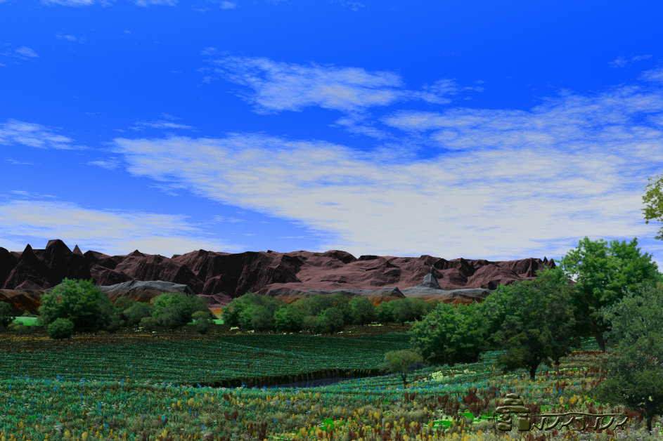
A picture along the Cartius River, north of the Plains. The Voltai Range in the rear. There are many plants flowering and the river should probably be wider - later I will change that. One of the tricky parts in working with these images is 'scale'. Consider this; at 1:10000 you have 1 unit equal to 10000 of the same units. Therefore 1 mm equals 10000 mm. That is the same as 100 m. I figure a pencil tip is 1mm or so in diameter. Set that on a line on a map and voila! - that tip represents 100 m at that scale. Hey...give me a break here a few meters. We do the blades of grass later for all those perfectionists out there. *G. Needless to say, all maps are incorrect. Just differing degrees of accuracy.
West of Tor, on the Lower Fayeen, a sluggish, meandering tributary, like the Upper Fayeen, to the Cartius, lay the river port of Kasra, known for its export of salt. Tribesmen of Gor Pg 32
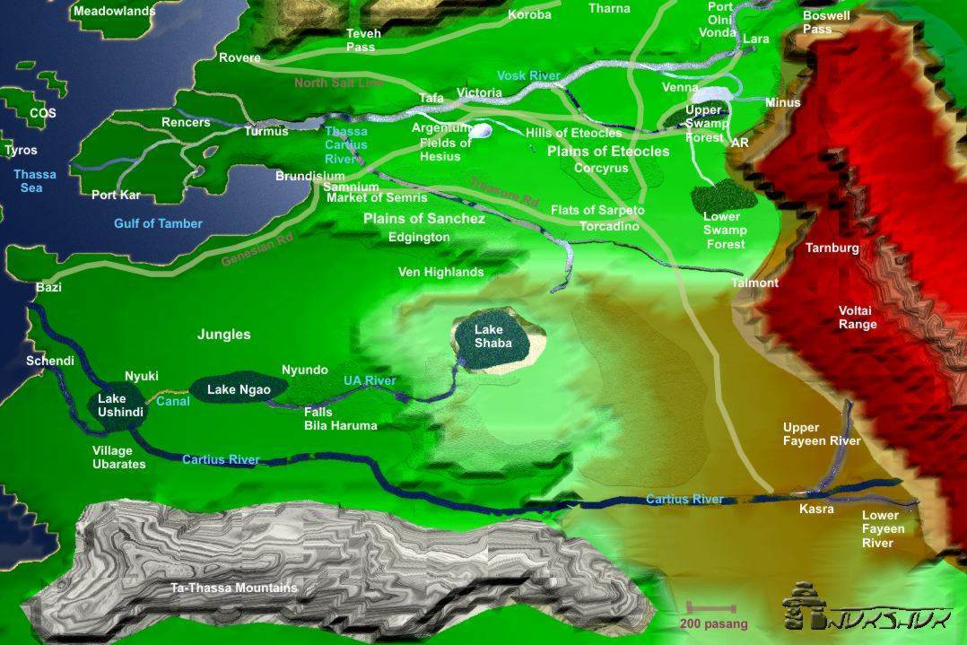
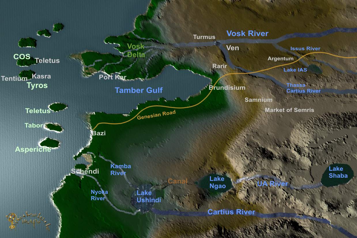
Finally, I zoomed in and made a final map of the region. This shows the lakes, rivers and some landmarks in the region. Notable changes, that differ from all other maps of Gor includethe following:
Lake Shaba is a mountain lake
The Cartius
drains into Lake Ushindi (there is no river called the 'sub equatorial
Cartius - that was/is this Cartius crossing the equator.
The Thassa
Cartius river begins north of Lake Shaba in the Ven Highlands.
The
North Salt line is about 400-600 pasang wide, but a much narrower area is
passable by wagon.
There is vegeation along the Cartius River
The
UA River is as wide as the Vosk, and very fast - it drops from high
elevation draining 400 pasang to the west into Lake Ngao
My thanks to 'autumn NS' for her help in this as well as Karnik, ARES and Tazmin. Right-click save for large clear map.
Inukshuk - 2002- 2004