Elevations and Locations
Northern Forest
When I began mapping the Northern Forest I thought it would be straight forward. That was not the case. The Northern Forests are vast. Their true size is not known - seemingly extending forever. It was at this point I began talking to others about geography and planets and round dimensions. How can it be that such a large area exists in Gor but has only one river? What is the slope of the land if the extents are not known? Needless to say this raised some interesting discussions. It was at this point I had to stop and think about the mapping within the context of Gor.
I encountered problems in mapping the forest which I partially address in this series. Those issues arose while trying to map the northern borders into Torvaldsland. You will see a new Torvaldsland later, it comes next. But for now, I am providing two maps in this series. One set of images depicts the Northern Forest with only the Laurius River. I did make another image though that has tributaries and rivers within forest - interpreted cartographically. And that is where I began to run into issues about this mapping.
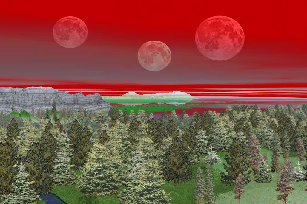
Let me clarify, all the maps you see in this series are quite accurate, based on the books of John Norman. In so far as that can be interpreted. I work from the Markus of AR maps, notes of 'autumn {NS}', my own interpretations and cartographic science. Generally speaking, all locations are accurate. The Northern Forest is breath-taking in 3-D. I was amazed when I stared to view it from different perspectives. In this series you will see many of those views.
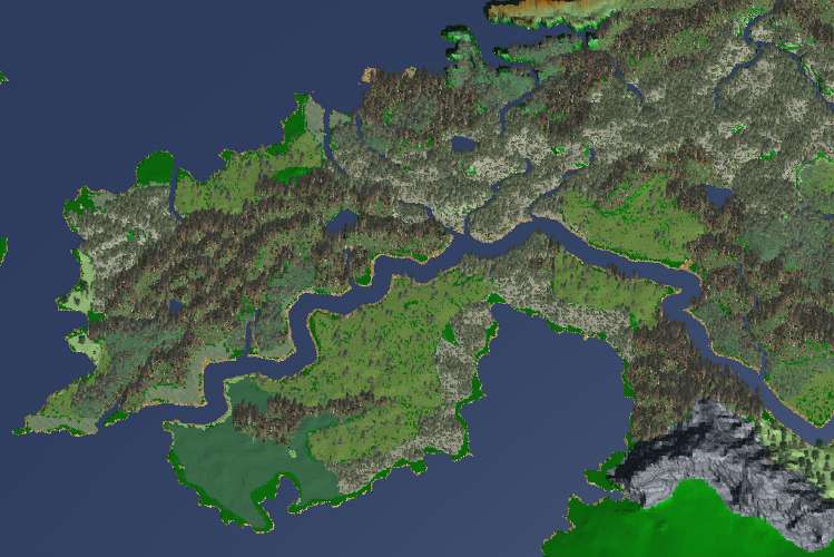
The Mapping of Gor is now generating 50,000 individual data points to form the landscape - first image.
It is not known how far these forests extend.
It is not impossible that they belt the land surfaces of the planet. They
begin near the shores of Thassa, the Sea, in the west. How far they extend
to the east is not known. They do extend beyond the most northern ridges
of the Thentis Mountains.
Captive of Gor Pg 129
The northern forests, the haunts of bandits and
unusual beasts, far to the north and east of Ko-ro-ba, my city, are magnificent,
deep forests, covering hundreds of thousands of square pasangs Assassin
of Gor Pg 293-294
The forests of the northern temperate latitudes of Gor are countries in themselves, covering hundreds of thousands of square pasangs of area.....It is not known how far these forests extend. It is not impossible that they belt the land surfaces of the planet. They begin near the shores of Thassa, the Sea, in the west. How far they extend to the east is not known. They do extend beyond the most northern ridges of the Thentis Mountains. Captive of Gor Pg 129
Yet on the trackless beaches, lining the western edge of the great northern forests for hundreds of pasangs, below the bleakness of Torvaldsland, it would not be easy to make rendezvous. Hunters of Gor Pg 243


The Northern Forests are bounded by the Hrimgar Mountains to the north. Thassa to the west. Laurius River to the south and extend indefintely to the east. In this mapping I extend them beyond Markus of AR maps to account for the vast horizon and taking into consideration the planet.
The first image to the right has some lakes and rivers and tributaries. These are all new and not accounted for in the chronicles. They are derived from understanding landscapes and cartographic knowledge - and consider the size of the forest.
The second image shows the ecosystems in the eastern portion. These lead into the Barrens which will come later.The vegetation decreases from trees to bushes to marsh and rolling lands but the trees extend beyond the Thentis Range.
We were fifty pasangs north of Lydius, which port
lies at the mouth of the Laurius River. Far above the beach we could see
the green margins of the great northern forests.
Hunters of Gor Pg 18
free port administered by Merchants, at the mouth of the Laurius where it empties into the Thassa. Goods, primarily rough goods like tools, crude metal and cloth are shipped from this port to many islands and coastal cities Captive of Gor Pg 59
"Lydius is a bustling, populous trade center located at the estuary of the Laurius River. Many cities maintain warehouses and small communities in Lydius. Many goods, in particular wood, wood products, and hide, make their way westward on the Laurius, eventually landing at Lydius, later to be embarked to the south on ships of various cities, lines and associations. The population of Lydius, as one might expect, is a mixed one, consisting of individuals of various races and backgrounds." Players of Gor Pg 12
He was bound, traveling over the hills and meadowlands
east and north of Ko-ro-ba, for the city of Laura, which lies on the banks
of the Laurius river, some two hundred pasangs inland from the coast of
the sea, called Thassa.
Captive of Gor Pg 59


We know from the books that the shores of the western edges of the forest extend several hundred pasang. Thus, the forest narrows to the west apporoaching the Thassa Sea. The Laurius River is large and slow moving, it can be travelled by barge.
In just about all of online Gorean role play of the Nothern Forest people are using the first image extents. Most Panther territories lie within the first image. The distances here are roughly 600 pasang by 600 pasang. The area is largely forested and several so called 'exchange points'lie to the north of the Laurius River in this image. They are usually denoted by inverse 'V's' from which slaves were traded in the spring usually.
Also known as exchange islands, they are administered
as Free Ports by the Merchants. Included are Teletus, Tabor, and Scagnar.
Others were Farnacium, Hulneth and Asperiche. In the south are Anango
and Landa, and in the far north, Hunger and Skjern, west of Torvaldsland.
These islands, and free ports on the coast such as Lydius and Helmutsport,
Schendi and Bazi make possible the commerce between Cos and Tyros and
cities of the mainland.
Raiders of Gor Pg 137
The governance of Lydius, under the merchants, incidentally, is identical
to that of the exchange islands, or free islands, in Thassa. Three with
which I was familiar, from various voyages, were Tabor, Teletus and, to
the north, offshore from Torvaldsland, Scagnar. Of these, to be honest,
and to give the merchants their due, I will admit that Tabor and Teletus
are rather strictly controlled. It is said, however, by some of the merchants
there, that this manner of caution and restriction, has to some extent
diminished their position in the spheres of trade....Hunters of Gor Pg
43
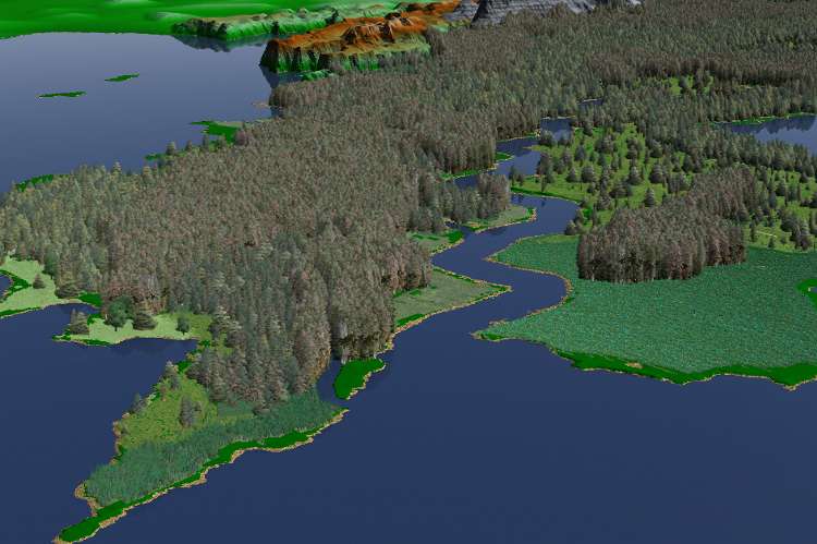
The first image is a low perspective of the mouth of the Laurius River. This is an interesting picture because it takes into account that Gor is round. All other maps appear flat, thus the angle at which the forest lays into the Thassa is significantly changed. In the background is Torvaldslland which I am hoping to map next.
The Meadowlands, a sparsely vegetated area of reeds and meadow vegetation is in the right. it is a beautiful place, colorful and has many talendar, dina, clover and Thentis Verminium - which by the way ka'reena {AoA} has been drawing and have been included in all these images.
The second image is looking from the Thassa Sea to the east along the Laurius River. The black Sardar Mountains can be seen in the middle and the Thentis and Voltai ranges.
a town at the northern bank of the forest, it
is a town of wood. The town is surrounded by a wall, with two gates, one
large, facing the inlet, leading in from Thassa, the other small, leading
to the forest behind the town. The main business of Kassau is trade, lumber
and fishing, particularly parsit fish from the plankton banks north of
the town. Lumber, particularly ka-la-na and tem-wood are traded to the
North, which is virtually treeless. Kassau is the seat of the High Initiate
of the North.
Marauders of Gor Pg 25-28
"The camp, and dancing circle, of Verna," said the first girl, Tana, "lies
north and east of Laura. Go to the slave compounds at the outskirts of
Laura. Then, where the forest begins, look for a Tur tree, blazed ten
feet above the ground, with the point of a girl's spear. From this tree,
travel generally north, seeking similarly blazed trees, a quarter of a
passang apart. There are fifty such trees. At the fiftieth there is a
double blaze. Go then north by northeast. Again trees are blazed, but
now, at the foot of the trunk, by the mark of a sleen knife. Go twenty
such trees. then look for a Tur tree, torn by lightning. A passang north
by northeast from that tree, again look for blazed trees, but now the
blazing is, as before, high on the trunk, and made by a girl's spear.
Again go twenty such trees. You will then be in the vicinity of Verna's
dancing circle. Her camp, on the north bank of a tiny stream, well concealed,
is two passangs to the north."
Hunters of Gor Pg 39
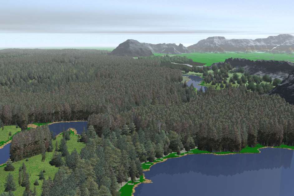
Same image as the one above, only the skie color is changed.
The second image is somwhat inland and looking down toward the City of Laura which would be in the clearings. Thassa Sea is in the background and the Laurius River can be seen.
The migration of the forest hurlit and the horned
gim do not take place until late in the spring.
Nomads of Gor, Pg 138
The mountains before me were black, except for
the high peaks and passes, which showed white patches and threads of cold,
gleaming snow. I looked for the green of vegetation on the lower slopes
and saw none. In the Sardar Range nothing
grew. Outlaw of Gor Pg 180
High on the beach, I saw two pairs of sloping beams. They were high,
large and heavy structures. The feet of the beams were planted widely,
deeply, in the sand; at the top, where they sloped together, they had
been joined and pegged. They were rather like the English letter "A,"
though lacking the crossbar. Within each "A," her wrists bound by wrapped
and taut leather to heavy rings set in the sloping sides, there hung a
girl, her full weight on her wrists. Each wore the brief skins of the
forest panthers. They were panther girls, captured. Their heads were down,
their blond hair falling forward. Their ankles had been tied rather widely
apart, each fastened by leather to iron rings further down the beams.
... It was an exchange point. ... It is thus that outlaws, to passing
ships, display their wares. Hunters of Gor Pg 18
We were a mere ten pasangs from the exchange point
where we had, the preceding day, obtained two panther girls. ... Male
and female outlaws do not much bother one another at the exchange points.
They keep their own markets. I cannot recall a case of females being enslaved
at an exchange point, as they bargained with their wares, nor of males
being enslaved at their exchange points, when displaying and merchandising
their captures. If the exchange points became unsafe for either male or
female outlaws, because of the others, the system of exchange points would
be largely valueless. The permanency of the point, and its security, seems
essential to the trade. - Hunters of Gor Pg 27


The first image is the Laurius River, it is accurate and I wanted to work with reflections. Realistically though I suspect the reflections on the Laurius would not be quite as clear. it is swift moving and muddy.
The second image depicts the western shores of the Northern Forest at the Thassa Sea. Lydius would be at the point in the middle of the image. The islands of COS and Tyros can be seen in this image as can the Ta-Thassa Mountains way down in the back. From the viewpoint to those mountains is some 8000 pasang or more.
The third image is above the Northern Forest looking toward the Teveh Pass - you can see it between the mountain ranges. Lake Shaba looms well to the back and the Ta-Thassa Mountains distant to the right.
The Sardar Mountains are known to be black. With no vegetation upon them. The third image shows this and looks off to the Thassa Sea. The Clearchus Forest is evident just to the top of the Sar''s and a little left.
The Hrimgar Mountains are not as rugged or formidable
as any of these chains, and they are penetrated by numerous passes. One
such pass, through which we trekked, is called the pass of Tancred, because
it is the pass used annually by the migration of the herd of Tancred.
Four days after leaving the northern edge of Ax Glacier, we climbed to
the height of the pass of Tancred, the mountains of the Hrimgar flanking
us on either side. Below the height, the pass sloping downward, we could
see the tundra of the polar plain. It is thousands of pasangs in width,
and hundreds in depth; it extends, beyond horizons we could see, to the
southern edge of the northern, or polar, sea.
Beasts of Gor Pg 192
Goreans care for their world. They love the sky, the plains, the sea,
the rain in the summer, the snow in winter. They will sometimes stand
and watch clouds. The movement of grass in the wind is very beautiful
to them. More than one Gorean poet has sung of the leaf of a Tur tree.
I have known warriors who cared for the beauty of small flowers. I personally
would not care to be the man responsible for them to be hunted down and
burned alive, their ashes scattered in expiation by mourning Goreans among
the charred wood and blackened stumps. Sometimes it takes, according to
the Goreans, a generation for the forest to forgive its injury, and return
to men, gracious and forgiving, in all its beauty.
Hunters of Gor Pg 119
The morning tide from Thassa was running in, swelling the river. I wished
to leave at the height of the tide. It would breast at the tenth Ahn.
It was late in the summer and the river was not as high as it is in the
spring. In the Laurius, and particularly near its mouth, there are likely
to be shoals, shifting from day to day, brought and formed by the current.
The tide from Thassa, lifting the river, makes the entrance to the Laurius
less troublesome, less hazardous.
Hunters of Gor Pg 68-69
I do not know," said Arn. "But from Lydius, he was to follow the river
to Laurius, two hundred pasangs upstream. Afterwards, he was to enter
the forest.
Hunters of Gor Pg 24
I lay in the center of a clearing. I could see lofty Tur trees surrounding
the clearing. We were deep in the forest, some where within one of the
stands of the mighty Tur trees. I where within one of the stands of the
might Tur Trees. I could see them, on all sides, at the edges of the clearing,
rising beautifully a hundred, two hundred feet toward the blackness of
the Gorean night, the brightness of the stars, and then, almost at the
top, exploding into a broad canopying of interlaced branches. I could
see the stars overhead. But through the leafed branches of the trees I
could catch only a glimpses of them. There was grass in the clearing.
I could feel it beneath my back. I saw, to one side of the clearing, a
short, stout slave post. with two rings. No slave was bound to it.
Hunters of Gor Pg 127


The first image is again along the western coast with a few knarled trees. The others show the Northern Forest from various viewpoints.
The Merchants, who control Lydius, under merchant
law, for it is a free port, like Helmutsport, and Schendi and Bazi, are
more interested in having their port heavily trafficked than strictly
policed. Indeed, at the wharves I had even seen two green ships. Green
is the color common to pirates. I supposed, did they pay their wharfage
and declare some sort of business, the captains of those ships were as
little interrogated as i. The governance of Lydius, under the merchants,
incidentally, is identical to that of the exchange islands, or free islands,
in Thassa.
Hunters of GorPg 43
We passed great piles of rough goods, which, later, would be loaded on
barges, for transport upriver to Laura, tools, metals, woolens. We passed,
too, through goods which had been brought downriver from Laura, and would
pass through Lydius, bales of sleen fur, and bundles of panther hides
and tabuk pelts. There would be better prices on sleen fur, of course,
in Laura itself. Too, from Laura, much in evidence, were great barrels
of salt, stacks of lumber, and sleds of stones, on wooden runners, from
the quarries to her east. We also saw cages filled with the blond village
girls, taken on raids to the north, they too, in their cages brought on
the barges downriver from Laura.
Hunters of Gor Pg 44
We passed some fortified warehouse, in which space is available to merchants.
In such places, there would be gems, and gold, silks, and wines and perfumes,
jewelries and spices, richer goods not to be left exposed on the docks.
In such houses, too, sometimes among the other merchandise, there are
pleasure slaves, trained girls, imported perhaps from Ar.
Hunters of Gor Pg 44
Lydius is one of the few cities of the north which has public baths, as in Ar and Turia, though smaller and less opulent. It is a port of paradoxes, where one finds, strangely mingled, luxuries and gentilities of the south with the simplicities and rudenesses of the less civilized north. Hunters of Gor Pg 45
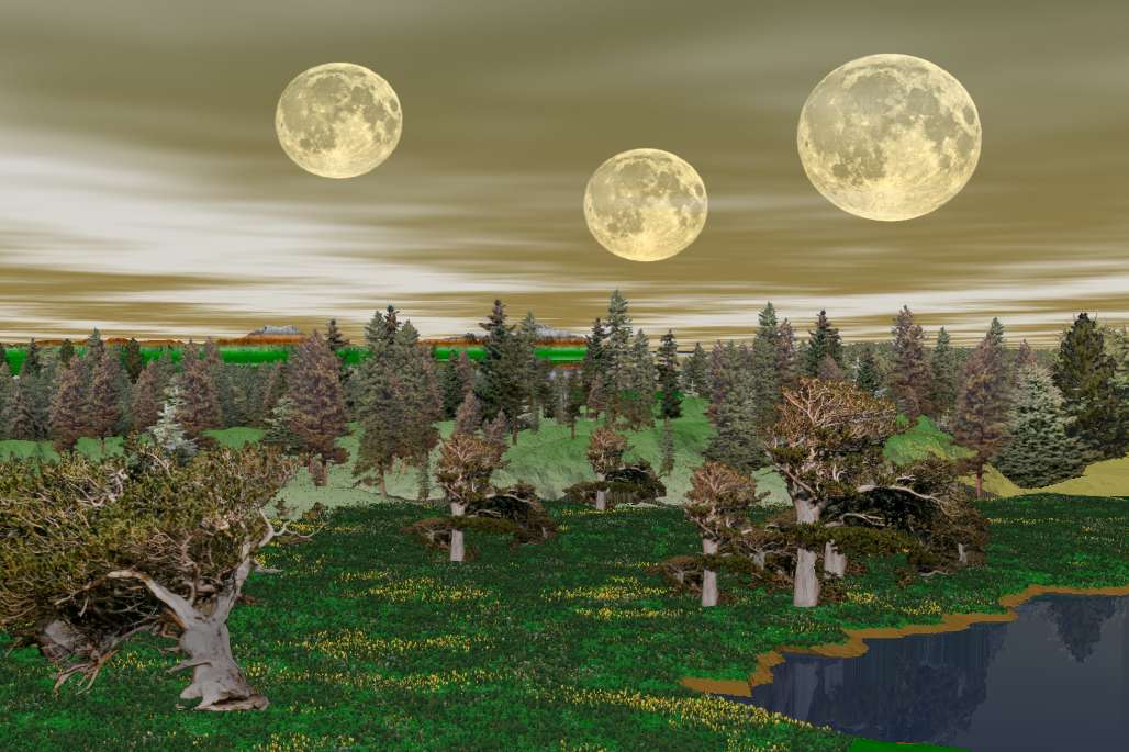

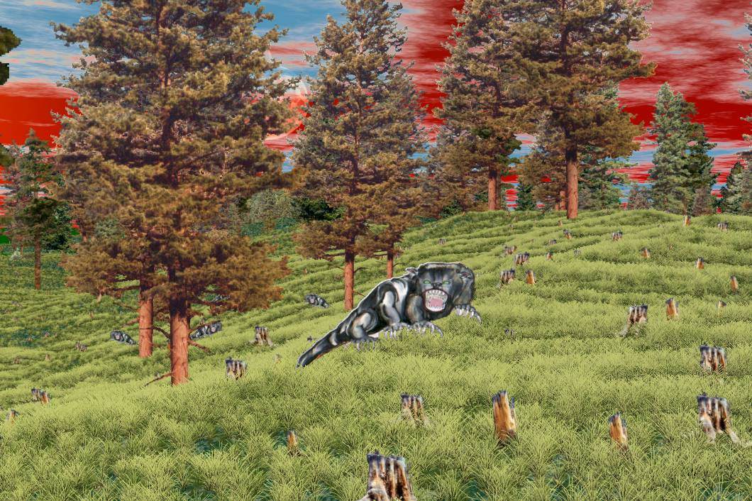
The Laurius River in the background, this image shows a small cabin and warehouse. The talendars are yellow and the clovers can be seen in the vegetation foreground - drawn by ka'reena. All of thse images are working from the original 3-D map. The cabins and trees are determined and placed on the original geography.
Those of Lydius pretend to much civilization,
and are fond of decorating their houses, commonly of wood, with high pointed
roofs, in manners they think typical of Ar, of Ko-ro-ba, of Tharna and
Turia, but to settle points of honor they commonly repair to a skerry
in Thassa, little more than forty feet wide, there to meet opponents with
axes, in the manner of those of Torvaldsland.
Hunters of Gor Pg 45

A forest sleen and verminiums - as drawn by ka'reena. The lower image includes some 'Thentis Verminiums' which are known to be bluish and found around the Thentis Mountains.


My thanks to 'autumn NS' for her help in this as well as Karnik. Thanks Tazmin.
All maps and images by Inukshuk may be freely used with acknowledgement.
Right click 'Save' for the larger images.
Inukshuk - 2004